increasingly popular map service provided by various vendors.
One of the most widely used is Google Maps, which in it has the StreetView feature.
Well, there are other similar services StreetView map, but using drone video.
One of the most widely used is Google Maps, which in it has the StreetView feature.
Well, there are other similar services StreetView map, but using drone video.
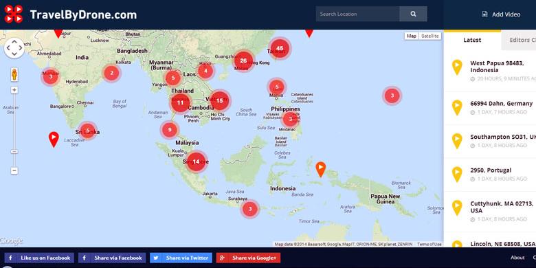
As quoted from BGR , the service map with names TravelByDrone ( travelbydrone.com ) is providing video footage taken by drones (unmanned flying vehicle), from various places. A place in the world that has a video recording drones will be marked on the map are displayed.
Site TravelByDrone is basically a site that was developed jointly by the user. In
this site, they can share drone video uploaded on YouTube, as well as
providing information on the location where the video was made.
Such information will appear on the map with a red pin marks. After the video was submit , a team of Traveling By Drone going to review the video before validating and publishing.
Once validated, the video footage taken by the drone will be displayed on the map.According to the monitoring KompasTekno ,
in Indonesia there are two places that have the drone video footage
uploaded to the site, three videos are in Bali, and one in Raja Ampat,
Papua.
So that the video can be validated, the TravelByDrone suggested that the video be taken by drones, have good quality, and include a clear location where the video was taken.
Videos will not be accepted if it is recorded in the room ( indoor ),
derived from military drones, or promotional nature, including
promoting products, politics, religion, or other personal messages.
In a statement, TravelByDrone says it does not store or have uploaded a video. All videos are retained by YouTube.
Here is an example of a video that is uploaded on the site Traveling By Drone, located at Raja Ampat, West Papua.
Source : Kompas
0 Response to "Exploring Bali and Raja Ampat in "TravelbyDrone""
Post a Comment